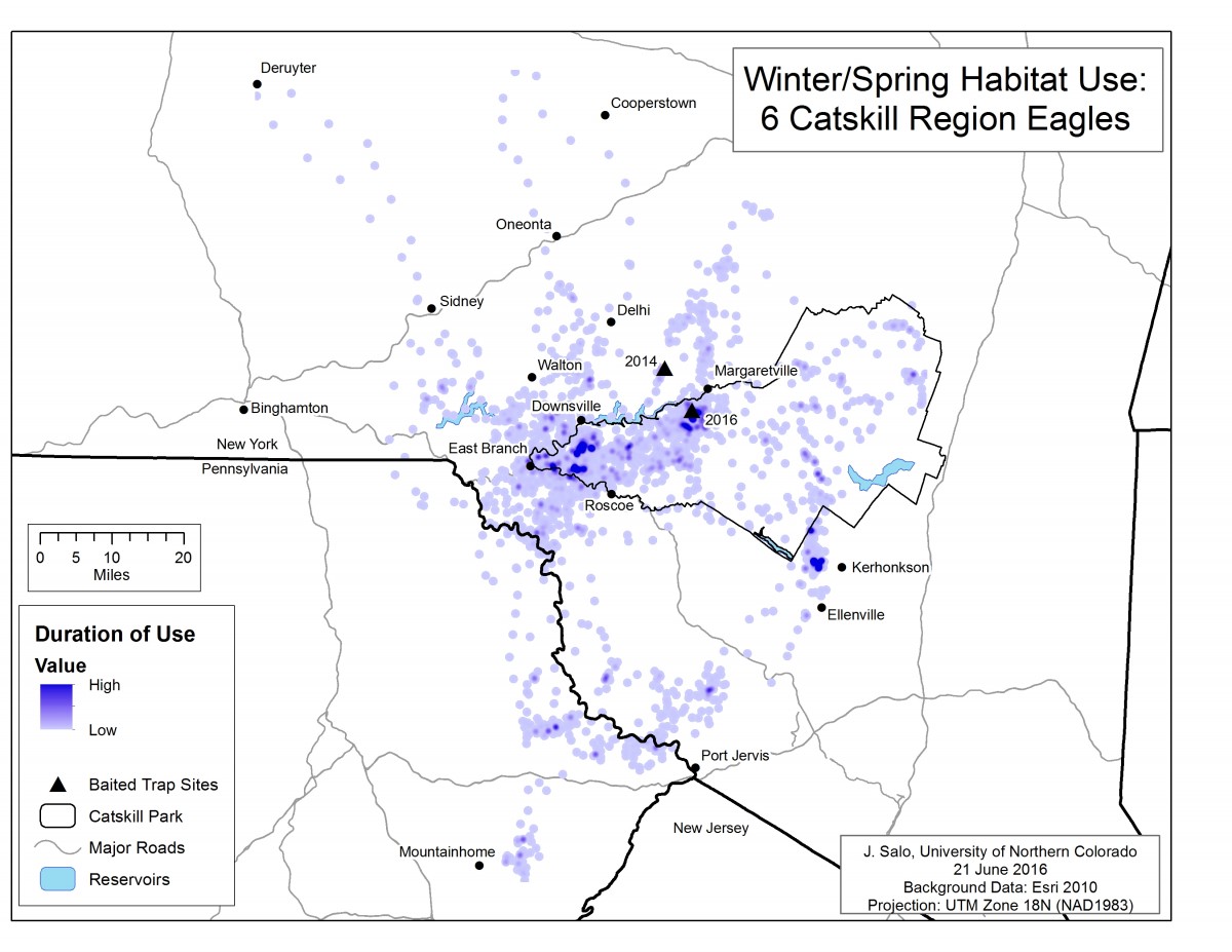
This map displays the density of use of habitat of six Catskill region golden eagles that were present during the winter and spring. Individual GPS data points can be seen where eagles were traveling. The darker areas are where eagles persisted. The triangles are sites where the eagles were caught and then released in 2014 and 2016.

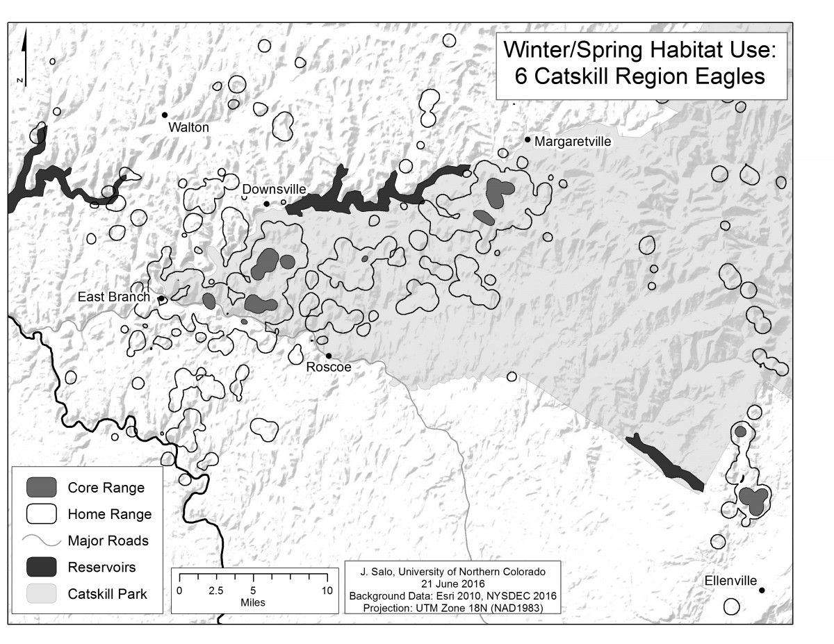
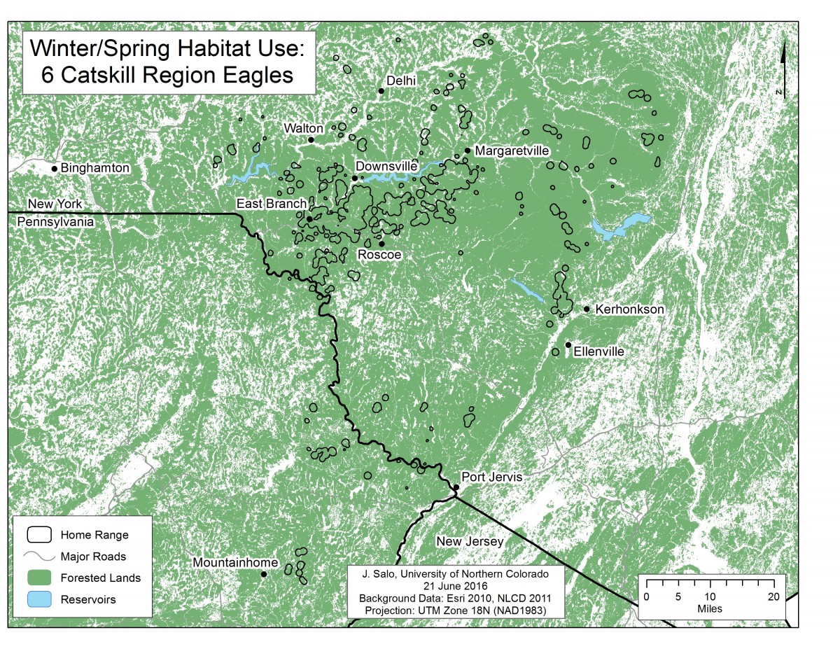
These GPS data collected from the six Catskill eagles were analyzed to understand where eagles were regularly found. From the duration of use estimates, data were grouped into two categories, the home range, where 95% of all GPS points were observed, and the core range, where 50% of all GPS points were observed. The birds’ home range totals 239.24 square miles, 92% of which is forested. The core range area is 12.21 square miles, composing only 5% of the larger home range.

The Catskill region birds’ home range totals 239.24 square miles, 220.5 square miles of which is forested (92%).


